Capability Statement
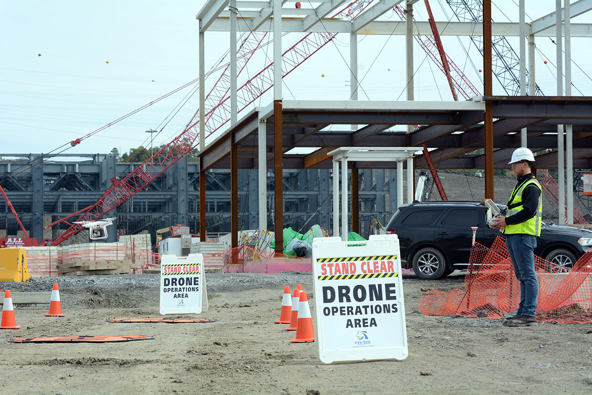
Eye-bot Aerial Solutions is a safety focused, full-service UAV (drone) provider. We use the latest technology to provide companies accurate, usable data that reflects the current state of their assets. We use a variety of data collection sources to ensure the most accurate and relevant data is delivered to you safely every time. Eye-bot offers full service and consulting on all our data collection, data processing and data delivery methods. As a safety driven service provider, we developed our Safety Management System based on the same regulations as a Commercial Airline, far exceeding the necessary safety standards set forth by the FAA.
Eye-bot Aerial Solutions specializes in the creation of high-resolution 3D “digital twins” of buildings and structures. In the global economy a single source of truth allows you to easily share this visual data with all necessary stakeholders around the world. This significantly reduces the need for onsite visits saving significant amounts of time and money. We can easily capture highly actionable 3d models at a rate of 250 acres per hour while offering industry leading processing times to give you access to your data almost instantaneously.
Differentiators
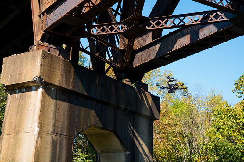
- Thermal, Confined Space, and Aerial Inspection
- Standardized operations and quality assurance processes
- Variety of Data Collection, Processing and Delivery methods to suit needs
- Site specific safety guide developed for every operation
- ASTM approved parachute system
- Safety Management System developed using manned aircraft regulations
- Drone, sensor and software agnostic
- Top or bottom mounted camera capabilities
- Multi-level risk mitigation
- Strategic industry partnerships with all major suppliers
- Non-invasive, easily implemented
- Industry leading data processing and delivery speeds
- Tier 3 and above pilots are OSHA 10 and confined space certified
Professional Highlights
Shell Pennsylvania Chemicals – $550,000 over 2018 – Ongoing contract through 2020 to perform data collection, processing and delivery of weekly 2D maps and 3D models of a 500-acre petrochemicals greenfield project. We also provide a myriad of other services including confined space and aerial inspections, thermal and 360-degree imaging.
Industries Served
- Government
- Oil and Gas
- Telecommunications
- Infrastructure
- Construction
- Insurance
- Power and Utilities
Past Performance

WE HAVE FULLY INSURED
REMOTE PILOT - FAA CERTIFIED